The immediate catastrophic threat hanging over rescue teams near the China-Nepal border has finally started to fade. Officials confirmed that the high-risk glacial lake, formed after a massive collapse triggered a violent torrent of rock, ice, and mud, has begun to safely recede.
If you have been tracking the aftermath of the disaster, you know the main fear wasn't just the initial flood that leveled the Gyirong border crossing. It was the ticking time bomb left behind. Debris from the collapsed glacier choked river systems, creating unstable natural reservoirs that threatened to burst and wipe out downstream rescue operations.
What Satellite Data Reveals About the Shrinking Lake
Panic is easy when communication lines are down and data is scarce. Real-time satellite surveillance changed the narrative.
Data from the Chinese Water Resources Ministry and state broadcaster CCTV showed that the reservoir on the Purepu Tsangpo river dropped significantly. Early Saturday morning measurements pinned the lake's surface area at 99,000 square meters—roughly equivalent to 14 football fields. That marked a shrinkage of 21,000 square meters in less than forty-eight hours compared to Thursday's tracking.
Parts of the lake bed are already visible. Water is cutting its own path through the natural debris dam rather than pooling into an explosive wall of water.
The Remaining Dangers in the Himalayan Valley
Natural drainage offers massive relief, but nobody is calling the area entirely safe. Secondary disasters remain a constant threat in the steep Himalayan terrain.
State-owned engineering enterprise China Anneng deployed specialized response teams equipped with drones, portable satellite stations, and mobile surveillance cameras to keep a 24-hour watch on the water levels. An initial overflow on Friday caused a temporary panic and halted rescue work until engineers could re-evaluate the stability.
Worse still, experts flagged a second, larger body of water sitting further down at the base of the collapsed glacier. Senior engineer Chen Hongqi from the Ministry of Natural Resources noted that this lower reservoir spans over 120,000 square meters. Its exact depth remains entirely unknown, keeping geologists on edge.
Nepal’s Disaster Management Authority maintains that flood warnings will stay active until both glacial water bodies are completely drained.
Ground Realities for Search and Rescue Crews
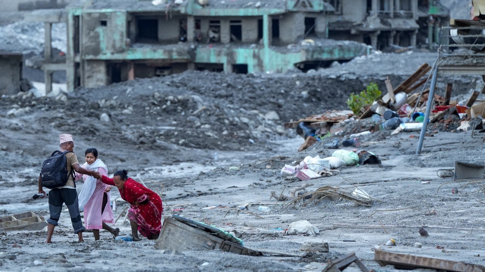
Working in the disaster zone is punishing. Heavy rain and grey, miserable weather greeted search parties combing through thick layers of grey mud and massive boulders.
Roads are destroyed. Communications are fractured. Over 50 rescue workers, aided by specialized search-and-rescue dogs, reached the flattened ruins of the border port complex. The human toll continues to climb as official counts tick upward, with hundreds remaining missing and economic damage estimates reaching billions of dollars.
Engineers remain confident that if outflows stay low, early warning systems can give workers at least a 30-minute buffer to evacuate if any sudden abnormalities emerge at the lake. Crews will press forward hour by hour as long as the mountains hold.