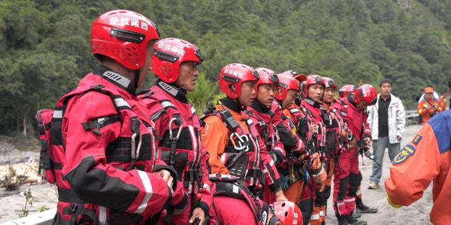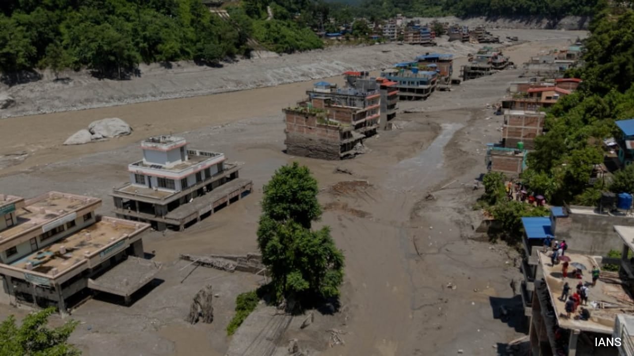
Every major newsroom is currently running identical panic pieces about a "dam burst" in Tibet triggering catastrophic flash floods across Nepal. It makes for great emergency broadcasting. Choppers hovering over mud-choked valleys, rescue workers scrambling, and a convenient villain: an artificial barrier or concrete structure across the border letting loose millions of cubic meters of water.
Except there is no major structural hydro-dam that suddenly shattered.
The lazy consensus in international reporting loves a trans-boundary infrastructure crisis because it fits neatly into geopolitical narratives. The reality documented by the United States Geological Survey and regional cryosphere scientists is far less convenient for headline writers. What actually happened along the Bhote Koshi and Trishuli river corridors was not the failure of a managed reservoir, but a high-altitude natural disaster: a massive rock-and-ice avalanche. A section of a retreating Himalayan glacier collapsed at roughly 5,200 meters, sending millions of tons of debris down into narrow mountain valleys. That debris temporarily choked the river channel, creating an unstable natural landslide dam that inevitably failed under hydrostatic pressure.
Blaming a "dam" is a category error that fundamentally misunderstands the geography of High Mountain Asia.
The Mechanics of a Cryo-Hydrological Catastrophe
To understand why traditional flood warnings and emergency protocols failed so completely during this event, you have to look at the physics of High Mountain Asia. The Hindu Kush Himalaya range is warming at roughly twice the global average—a phenomenon known as elevation-dependent warming. This rapid thermal shift does two things simultaneously: it thins unstable ice fields and drives an explosion in the number of glacial and supraglacial lakes. Data from regional monitoring networks shows thousands of these volatile bodies sitting precariously in upper mountain catchments.
When an ice-rock avalanche drops over a vertical kilometer onto a valley floor, it does not just splash into a river. It acts as a massive kinetic battering ram. The mixture of ice, water, and pulverized sediment bulks up as it rushes downstream, transforming a standard flow into a high-density debris torrent capable of moving boulders the size of delivery trucks at highway speeds.
When reports emerged that a barrier lake on the Tibetan side had breached and forced the temporary suspension of rescue operations, media outlets immediately pivoted back to the "burst dam" panic. But a landslide dam (or moraine dam) is governed by geotechnical rules entirely different from engineered concrete. These natural blockages are composed of loose, unconsolidated sediment and ice fragments. They are structurally doomed from the moment they form. Excavating a manual drainage channel—the standard engineering response deployed by teams on the ground—is a desperate race against inflow rates, not a matter of closing a sluice gate. Treating these events as sudden industrial accidents lets governments off the hook for failing to build comprehensive cryo-hydrological monitoring systems.
Why Current Early Warning Systems Are Broken
Governments across the Himalayan arc rely heavily on meteorological rain gauges to trigger flood alerts. That methodology is fundamentally obsolete.
The disaster along the Nepal-Tibet border featured zero significant rainfall beforehand. There was no monsoon cloudburst, no overflowing agricultural basin, and no storm warning to flash across mobile phones. Traditional river-gauge stations placed miles downstream only registered the crisis when the water level spiked by up to nine meters in under thirty minutes. By then, the warning window was measured in seconds.
When you design early warning infrastructure based solely on precipitation metrics, you are fighting the last war. Climate adaptation in the Himalayas requires real-time satellite radar tracking of slope stability, acoustic sensors for rock-ice avalanches, and automated thermal imaging of high-altitude glacial lakes. Spending millions on downstream embankments while ignoring the upper ablation zones is like building a stronger umbrella while standing under an active volcano.
The Cost of Geopolitical Finger-Pointing
Framing these disasters as cross-border infrastructure failures introduces toxic political friction where technical cooperation is desperately required. When an ephemeral barrier lake forms in Tibet and threatens downstream settlements in Nepal, blaming upstream neighbors for "failing to manage dams" triggers defensive diplomatic postures.
Engineers and hydrologists on both sides of the border understand the reality: these ephemeral landslide-dam outbursts (LLOFs) and glacial lake outburst floods (GLOFs) do not respect international borders. They are systemic outcomes of a destabilized cryosphere. Data-sharing agreements must be instantaneous and decoupled from political friction. If hydrologists in Lhasa and Kathmandu are not sharing satellite telemetry on basin swelling within minutes of an anomaly, hundreds more people will be swallowed by sudden mudwalls while rescue teams are forced to retreat.
Stop looking for a concrete villain in the mountains. The threat is systemic, thermodynamic, and accelerating. Until disaster management shifts from reactive rescue operations to high-altitude cryospheric surveillance, every subsequent melt season will bring a repeat of the same tragedy.